Pilot Project
Curbside Data Management
Objective
Enable cities and companies to communicate clearly about curb regulations to enable better analysis, planning, and management of public space.
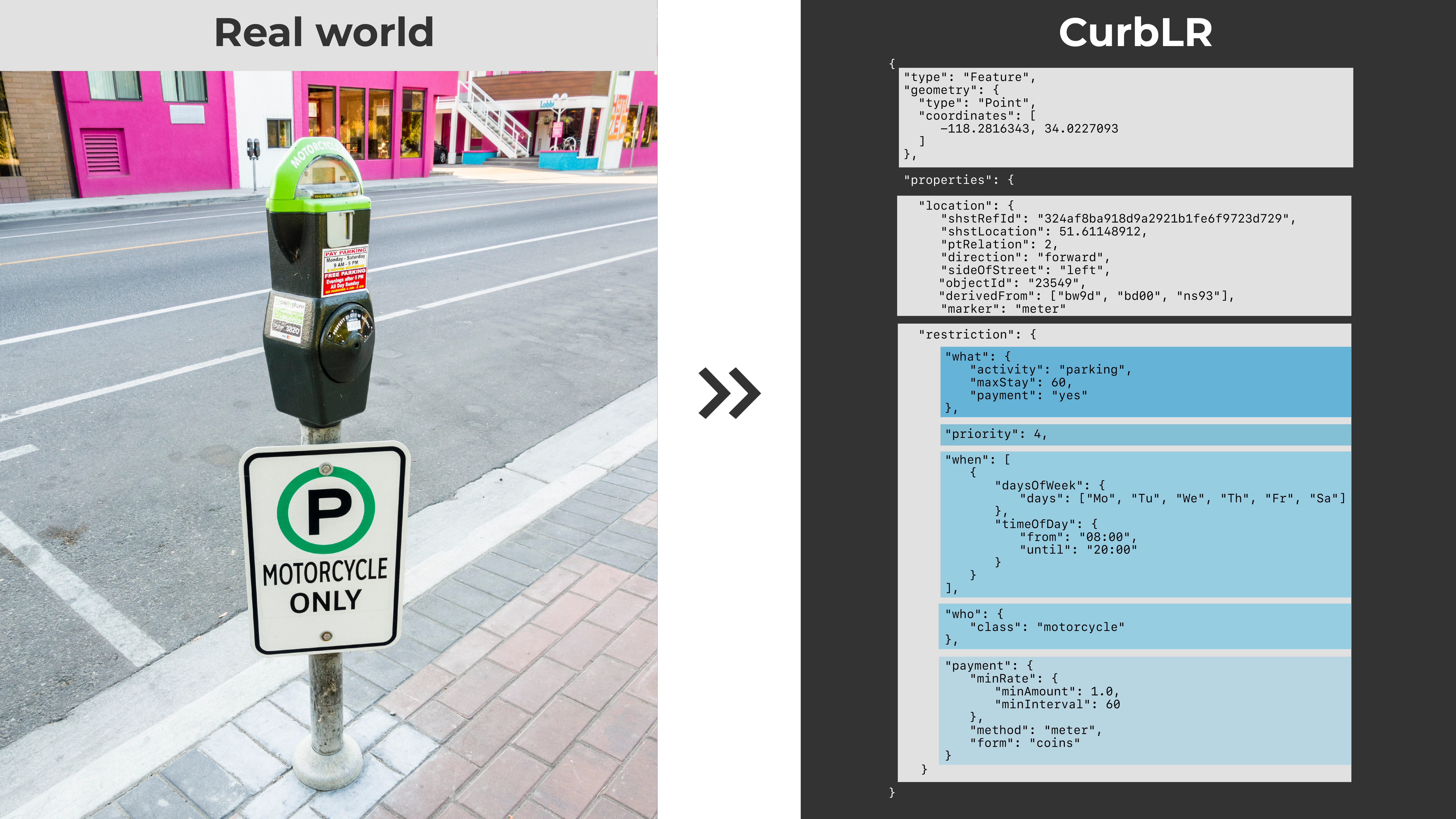
We're working with cities, partners, and organizations around the world to develop an open data standard for the curb: CurbLR. CurbLR provides a structured way for all cities to store and share essential curb information, incorporating asset information that’s been linear referenced onto the street using the SharedStreets Referencing System. It’s a common language on which many things can be built, including tools to analyze and map how space is allocated, or apps to help route people to parking and make curb usage more seamless.
Having access to standardized data and common tools will empower cities to better manage their curbs today and build from existing regulations to change their curbs over time as mobility options change.
Read more about CurbLR in our blog, and check out the full details on GitHub.
Partners
- Ford
- Cities TBA Summer 2019
Toolkit Workflow
Referencing System + API
Curb data is mapped as individual asset points, such as the location of sign posts, parking meters, and curb paint. These points are linear referenced back to the street using the SharedStreets Referencing System, and are converted into segments of the street. This location information enables CurbLR to refer to the street sections in a universally-understandable way.
Data Standards
CurbLR provides an open data standard that cities, companies, and civic tech groups can use to produce, share, and consume data in a common format. Until CurbLR, cities have each had to develop their own format for managing curb data, and there was no common, open standard on which tools could be built.
User Interface
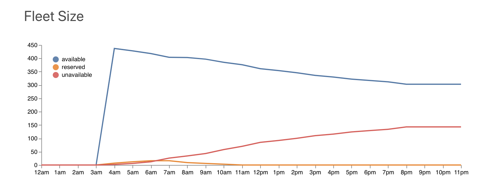
We'll be building out processing tools and working with city partners to produce visualizations over the coming months - check back soon!
FAQ
Q: Where is the project at right now (June 2019)?
A: We've released a working draft of the data standard, CurbLR and are currently working with parking standards organizations, cities, and companies like Ford to refine it. We'll release an updated version over the summer that will be ready for use.
Q: How do I produce my own curb data set?
Curb data can be mapped as asset points and linear referenced using the SharedStreets toolset. We're currently building out additional capabilities so that the command line tools can convert points into street segments.
Q: Can I map my city's curb data in OpenStreetMap?
A: We're actively engaging with the OpenStreetMap community to consider potential ways that curb regulations could be mapped in OSM. Read more here.

Get Involved
Do you work for a city or government agency? A private company? Or are you an independent researcher or developer? Learn how to start using the SharedStreets Toolkit.
Get Started