Why Do We Need a Shared Referencing System?
By Emily Eros in Data Deep Dive · May 1, 2019
Most cities today collect and manage extensive datasets for their street networks using geographic information systems (GIS). Likewise, more and more private companies are generating street data as they oversee rideshare operations and micromobility fleets. Despite the abundance of data, considerable barriers limit what’s possible for internal data management and external collaboration.
The Problem: maps can’t talk to each other
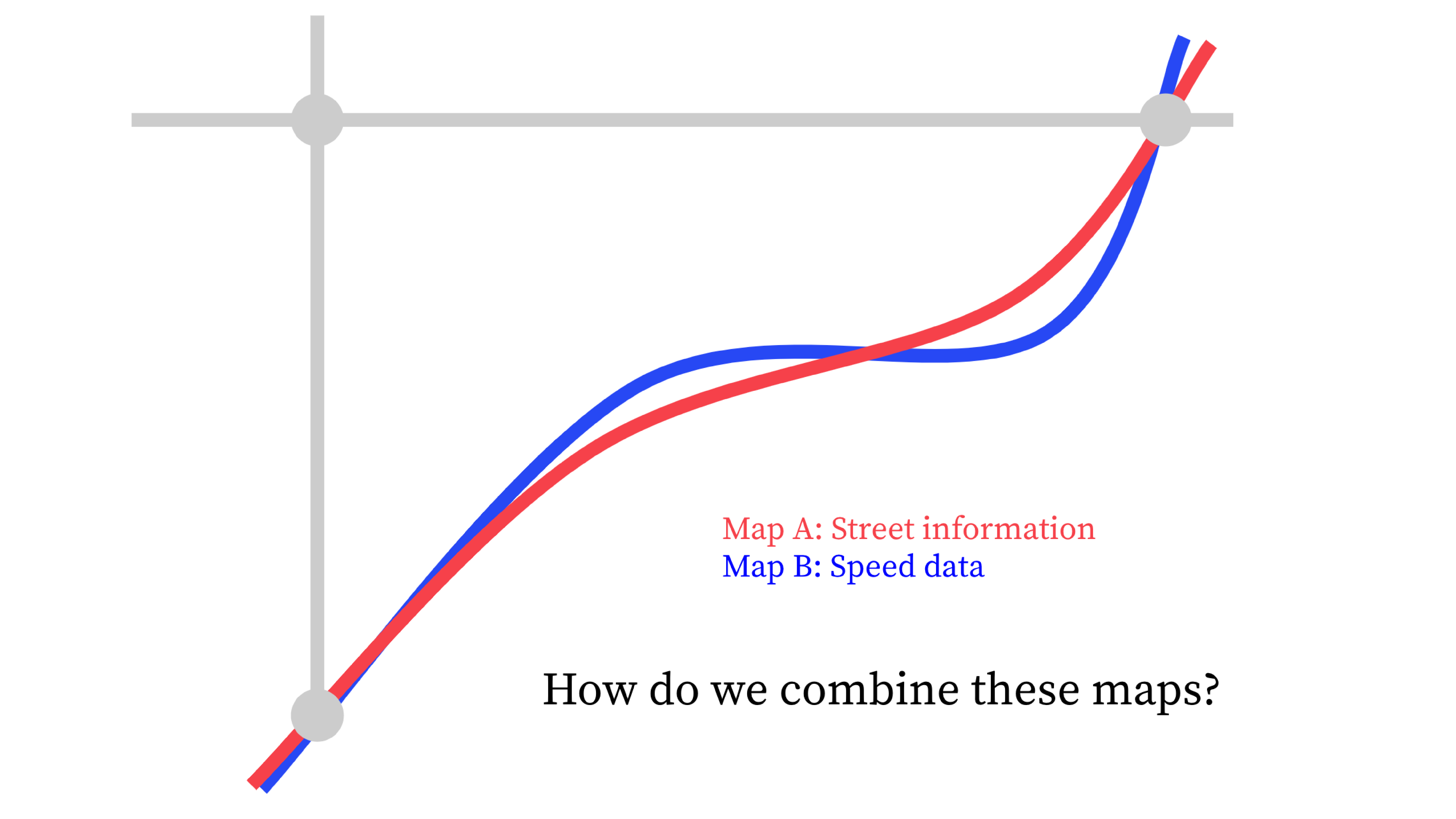
A common problem is that different maps can’t talk to one another. A city may have a GIS dataset for its street centerlines, but it’s difficult to connect this to data for other features on the street, like sidewalks, curbs, parking regulations, and bus stops. This can lead to siloed datasets that are messy and time-consuming to combine.
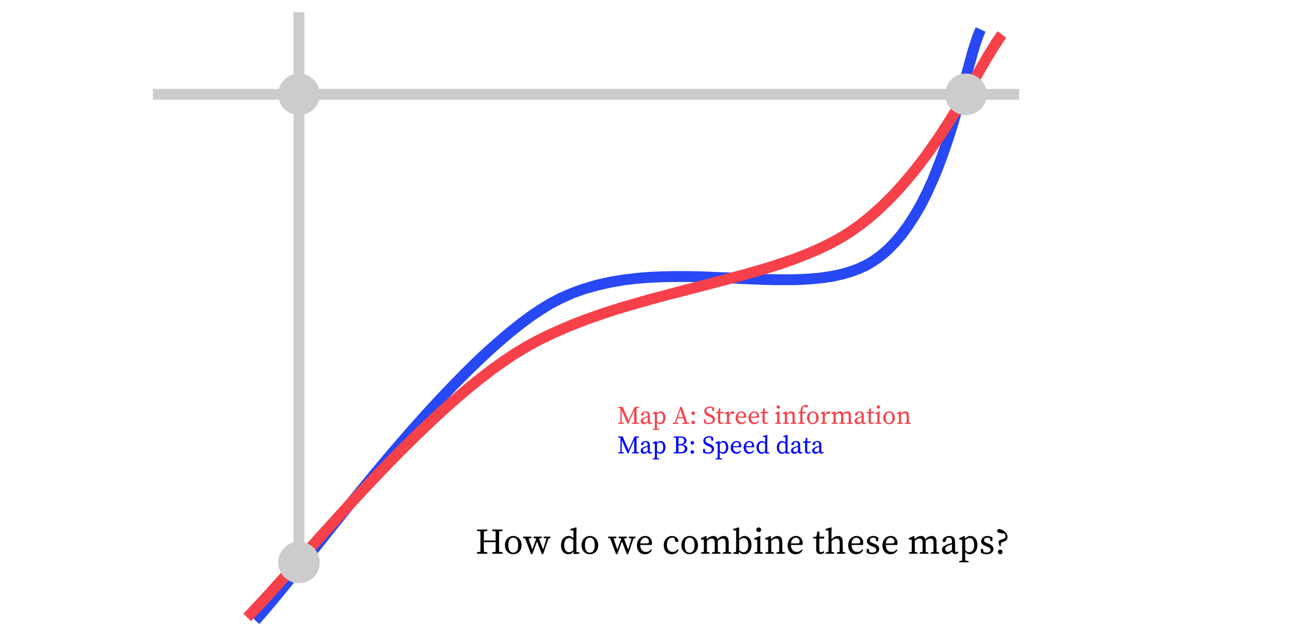
This gets even harder when considering movement data, such as vehicle speeds, rideshare pick-ups and drop-offs, and dockless mobility trips. This type of data is generated by private companies that usually don’t share the same basemap as the city. In order to exchange data, users must extensively process the data, agree on a map, or use predefined and often proprietary IDs to describe streets.
This limits cities’ ability to answer questions about what’s taking place on the street, and how to plan for and manage transportation systems. It’s difficult to relate datasets to each other to examine things like which streets have the most significant speeding problems, how this relates to bike and pedestrian infrastructure, and where safety improvements would be most needed. Or where and when rideshare pick-ups and drop-offs are happening the most, how the curb space is allocated along those areas, and whether it would be appropriate to reallocate parking space towards pick-up and drop-off zones during certain times.
We live in a time where there’s never been so much data about our cities, yet it’s often difficult to get information.
These are the types of problems that SharedStreets was created to solve. We are a project of the Open Transport Partnership, an independent non-profit that builds open source software, digital infrastructure, and data governance models to support new ways of managing and sharing data in order to keep cities moving.
At the heart of our work is global, non-proprietary system for describing streets and connecting street-linked data. This creates a way to refer to each street segment (and locations along it) uniquely and consistently, using a “Reference ID”. Users are then able to move attributes between different street representations, whether the data are linked to a city-managed GIS system, OpenStreetMap, or a commercial basemap. This allows public and private entities to communicate with clarity and precision about streets while ensuring full compatibility with organizations’ internal map data.
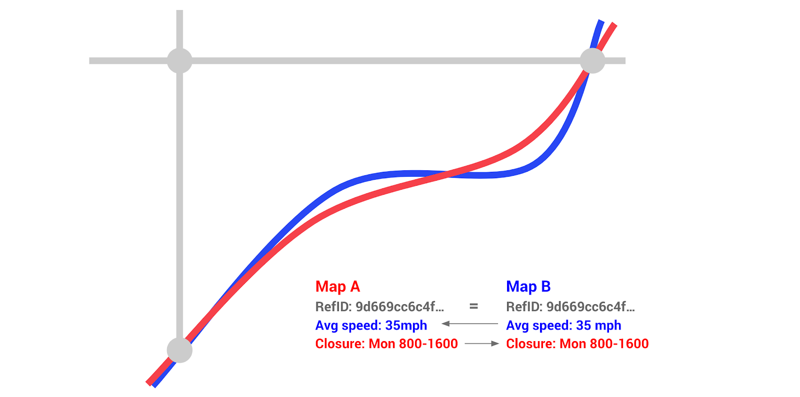
In addition, we develop tools built on our referencing system that provide transparent and standardized ways for cities and private companies to communicate about specific needs - including street closures, taxi and rideshare activity, micromobility, and the curb (coming soon!). We produce open metrics that protect individual privacy by anonymizing and aggregating sensitive, individual trip data. This enables public-private collaboration and the seamless exchange of transport data, empowering cities with the information they need to make policy and infrastructure decisions.


Get Involved
Do you work for a city or government agency? A private company? Or are you an independent researcher or developer? Learn how to start using the SharedStreets Toolkit.
Get Started